VMap0 data in ESRI shape format
Downloadable VMap0 data. Description and field notations can be found in linked articles.
Обсудить в форуме Комментариев — 19
VMap0 data are relatively new vector dataset which represents a next version of widely used Digital Chart of the World (DCW) dataset (more about VMap0 - rus).
Global VMap0 dataset is distributed in original VPF format and available through National Geospatial-Intelligence Agency website. This page allows to download exact replica of VMap0 in ESRI shape format. The dataset is in public domain with the exception of Boundaries Coverage and the Reference Library layers that are copyrighted by ESRI (allowed use limitations are unknown, so the layers are still published here as in source VPFs).
Data are packed with free 7z compressor.
All the data are in Latitude/Longitude, WGS84 coordinate system.
You can also get PRJ files here.
Global data
Global data are separated into 4 parts and available to download from this website in ESRI Shapefile format (see figure, zones boundaries, shapefile):
Data in SQL format ready for uploading into PostGIS/PostgreSQL
Data is converted using the following routine :
for f in *shp
do
  #remove extension and substitute "-" for "_"
  name=$(basename $f .shp| tr "-" "_")
  #convert file $f from shp to sql commands
  shp2pgsql -d -I -s 4326 $f $name > ./sql/$name".sql"
done

Data for the territory of Russia
Data for the territory of Russia in ESRI Shapefile format is available here.
Data are imported from VPF, clipped with Russia's boundart from the same dataset and merged together from the Eur, Noa and Sas parts, each layer has accompanying legend as an avl-file.
Download database for the whole country, 113 Mb
Download by subject (each archive can contain several layers):
Boundaries
Boundaries (2Mb)
Boundaries, delimiters removed and with attributes added (2Mb)
Countries boundaries only (8Mb)
Countries boundaries divided by zones (8Mb)
Other
Auxillary layers (data quality, grids etc.) (2Mb)
Elevation (37Mb)
Hydro - points (<1Mb)
Hydro - lines (9Mb)
Hydro - areas (6Mb)
Industry (<1Mb)
Physical geography (<1Mb)
Populated places (<1Mb)
![]() Populated place with Russian names and additional attributes (details in Russian )
Populated place with Russian names and additional attributes (details in Russian )
Transport (4Mb)
Infrustructure (1Mb)
Vegetation (16Mb)
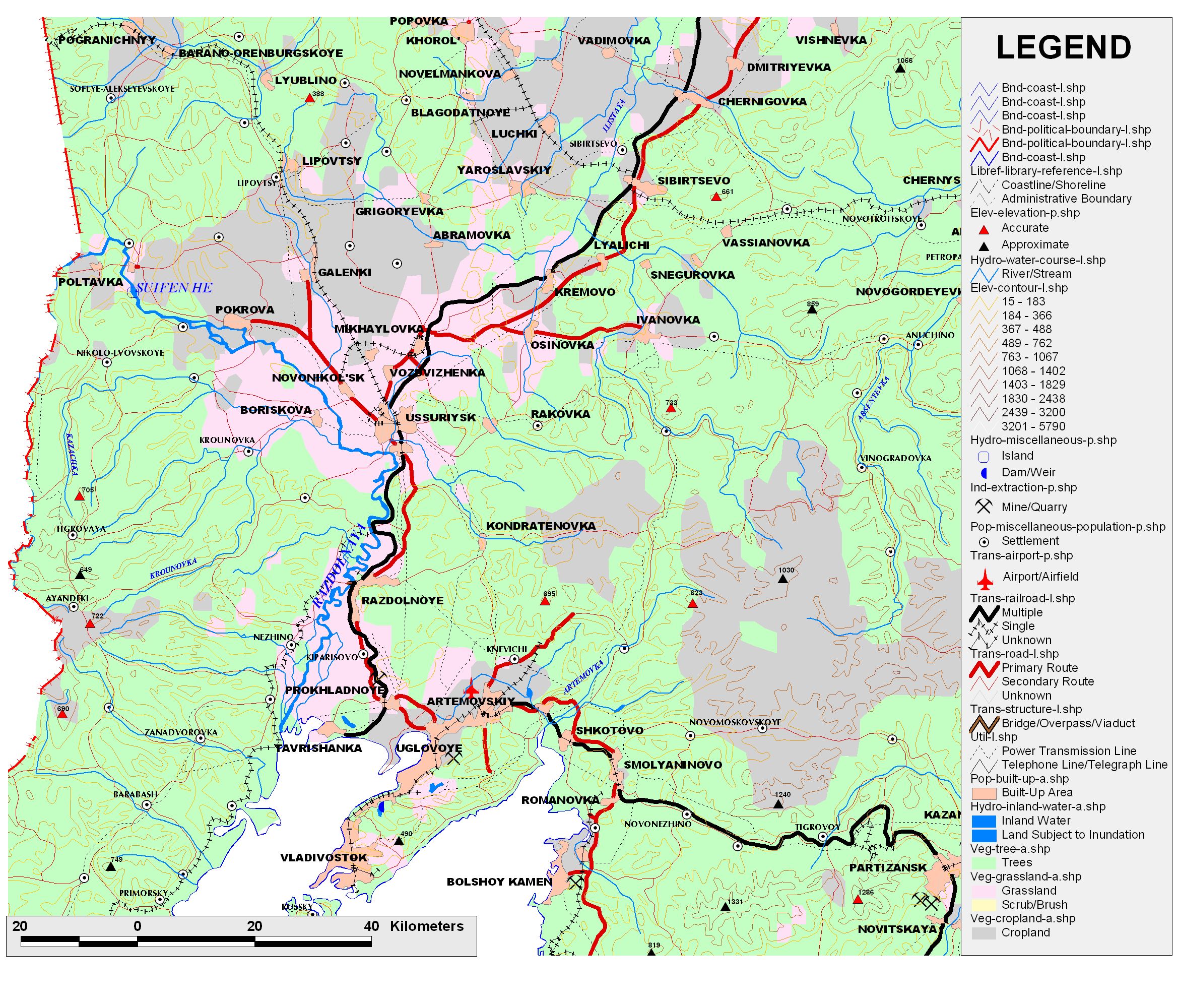
Example build from VMap0 dataset (click on the figure to see bigger one with the legend).
Обсудить в форуме Комментариев — 19
Ссылки по теме
Последнее обновление: September 09 2021
Дата создания: 23.04.2006
Автор(ы): Максим Дубинин


© GIS-Lab и авторы, 2002-2021. При использовании материалов сайта, ссылка на GIS-Lab и авторов обязательна. Содержание материалов - ответственность авторов. (подробнее).