Transfer vector features from QGIS to Google Earth
Обсудить в форуме Комментариев — 17Редактировать в вики
по адресу http://gis-lab.info/qa/qgis2google-eng.html
Instrument description and ways to get it.
This extensions allow running Google Earth and transfer vector objects from QGIS map canvas. Layers opened in GE are stored in temporary folder and removed after QGIS is closed. Layer symbology can be imported from QGIS layers or set up separately. If attribute table contains populated NAME field, its value is also imported. This tool works only with vector layers.
Native data CRS should be Geographic (lat/long), WGS 84 (EPSG:4326), data can also be in other geographic CRS, but will be treated as 4326. The CRS of the map canvas is not important, if you want you can set the projection to anything you'd like, only native CRS will matter. If after transfering, Google Earth zooms in to the area around 0,0, you need to check native CRS of your data, most probably it is not Geographic, but projected.
Installation notes[править]
The plugin sources and ready to run binary files for Windows are available.
Binary files[править]
To work with plugin under Windows you need:
- download and install QGIS 1.8 or higher (read more)
- download plugin
- copy plugin into QGIS plugins directory (usually C:\OSGeo4W\apps\qgis-dev\plugins)
To work with plugin under Linux you need:
- install QGIS 1.8 or higher. If packages for your distribution are not available — you need to compile QGIS from source
- download plugin
- copy plugin into QGIS plugins directory (usually /usr/lib/qgis/plugins)
After installing you should run QGIS and enable the qgis2google in Plugin Manager ("Modules → Manage plugins").
Source code[править]
You can obtain sources (GNU GPL v2) from our Github page:
git clone git@github.com:nextgis/qgis2google.git
How does it work[править]
After plugin activation a new toolbar appears
"Send feature" tool[править]
This instrument is used to click on the feature of the active layer. The feature being clicked is converted in KML and transfered in Google Earth.
"Send layer" tool[править]
This instrument transfers the whole active layer. Single symbol or unique value symbology can be imported as well as layer transparency.
Plugin settings[править]
This button opens plugin settings dialog
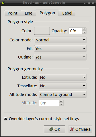
Here you can configures alternative symbology to used when "Override layer's current style settings" is switched on.
Demo[править]
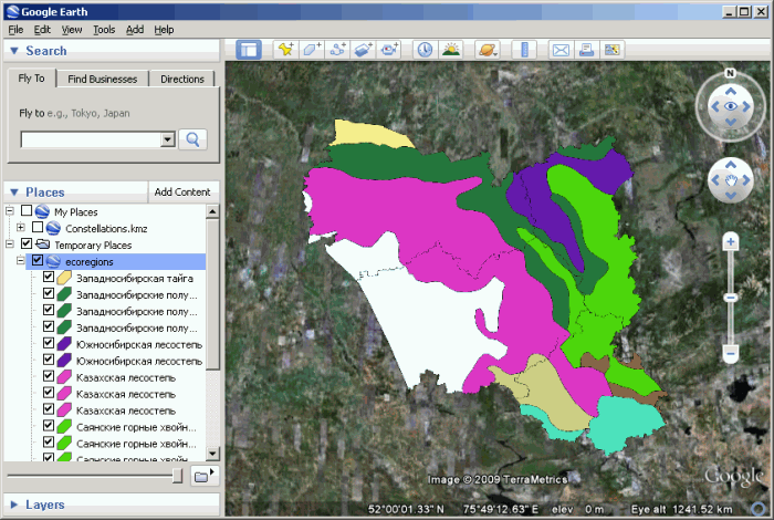
You can also check out the demo (how to open Ecoregions layer from Geosample data set in Google Earth).
Warning: video size is about 100 Mb.
Contacts[править]
If you want report a bug, make suggestion or have a question about the plugin, please contact us.
Ссылки по теме[править]
Обсудить в форуме Комментариев — 17Редактировать в вики
Последнее обновление: 2014-05-14 22:43
Дата создания: 08.12.2008
Автор(ы): Максим Дубинин
© GIS-Lab и авторы, 2002-2021. При использовании материалов сайта, ссылка на GIS-Lab и авторов обязательна. Содержание материалов - ответственность авторов. (подробнее).


