Georeferencing raster data in QGIS using polynomials
Description and latests news about development of enhanced Georeferencer plugin.
Обсудить в форуме Комментариев — 12
Important: this page is outdated and left for historical purposes. Georeferencing module is included in QGIS core and does not require separate installation anymore. The process of georeferencing is described in details in "Geographic referencing of the data with QGIS" (article available only in Russian).
Contents
1. Description
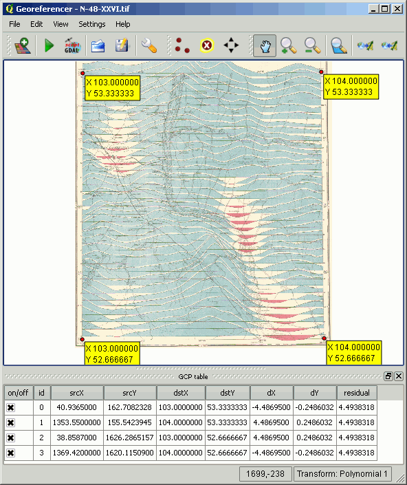
Georeferencing of raster data in QGIS is accomplished using Georeferencer plugin (more in Russian). However this module allows transforming rasters using so called Helmert transformation, which is shifting and translating rasters. Obviously, this is not enough to georeference distorted materials, like scanned ones.
It is possible to use other software, such as GDAL (more in Russian), which allows to use more appropriate polynomial transformations (more in Russian). As QGIS includes GDAL functions, it is possible to use them to enhance Georeferencer functionality using them.
Enhanced Georeferencer can perform 1st, 2nd, 3rd order polynomial and thin plate splines transformation.
2. Download
Source code for the enhanced Georeferencer module can be obtained from SVN.
svn checkout http://svn.gis-lab.info/qgis-gdal-georef/trunk/ georeferencer
Or get separate binary dll for Windows (latest trunk).
3. Install
To install on Windows, copy dll to C:\OSGeo4W\apps\qgis-dev\plugins\
To install this plugin from source code, it is necessary to first install from source codes QGIS itself (more in Russian), after the plugin is installed like that:
cd build
rm -rfv src/plugins/georeferencer
cd ../src/plugins/
rm -rvf georeferencer
svn co http://svn.gis-lab.info/qgis-gdal-georef/trunk georeferencer
cd -
make georefplugin
make install
Installed plugin replaces current Georeferencer. Plugin is tested in OSGeo4W QGIS-1.5 and under Mandriva Linux.
Обсудить в форуме Комментариев — 12
Последнее обновление: September 09 2021
Enter
What's new 
Creating multi-level tiles from QGIS project with QTiles 
Rendering vector data with Mapnik without direct access to the storage
Geoprocessing with SEXTANTE for QGIS
Remote sensing Corona data - description and access
Subscribe to news
New on forum
Feedback
© GIS-Lab and authors, 2002-2013. Attribution to GIS-Lab and authors is required. The responsibility for the content of this article rests with the author (more).